Property Record
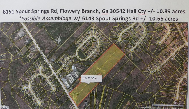
6151 Spout Springs Rd, Flowery Branch, GA 30542

NEARBY LISTINGS FOR SALE OR LEASE
Property Detail
6151 Spout Springs Rd
Gainesville, GA
6151 SPOUT SPRINGS ROAD
15-00046-00-079
Hall
Privatepreserveopenspacevacantlandforestlandconservation
Georgia
A
0
13139C0292G
10.78 AC
2025
Gainesville/Hall County
2025
Atlanta
001610
DEMOGRAPHICS near 6151 Spout Springs Rd
1 Mile
3 Mile
5 Mile
2024 Total Population
3,988
29,750
76,762
2029 Population
4,451
33,406
85,612
Pop Growth 2024-2029
+ 11.61%
+ 12.29%
+ 11.53%
Average Age
38
39
40
2024 Total Households
1,312
10,523
27,108
HH Growth 2024-2029
+ 11.51%
+ 12.25%
+ 11.57%
Median Household Inc
$94,059
$81,186
$80,762
Avg Household Size
3.00
2.80
2.80
2024 Avg HH Vehicles
2.00
2.00
2.00
Median Home Value
$253,262
$295,474
$305,507
Median Year Built
1998
2002
2002
Nearby Places
Map Layers
Map Styles
 Street
 Aerial
- Restaurants
- Banks
- Shops
- Fitness
- Groceries
SALE & LEASE HISTORY
LISTING DATE
SALE/LEASE

Sep 24, 2016
For Sale
Sep 08, 2017
For Sale
Nearby Properties
Address
Land Use
TOTAL SIZE
Lot Size
Zoning
Address
Land Use
TOTAL SIZE
Lot Size
Zoning
5,760 SF
38.07 AC
R-III
Address
Land Use
TOTAL SIZE
Lot Size
Zoning
102,060 SF
31.90 AC
R-1I/H-B
Address
Land Use
TOTAL SIZE
Lot Size
Zoning
85,900 SF
25.29 AC
H-B
Address
Land Use
TOTAL SIZE
Lot Size
Zoning
164,815 SF
29.93 AC
R-IV
Address
Land Use
TOTAL SIZE
Lot Size
Zoning
273,101 SF
126.33 AC
PRD
Address
Land Use
TOTAL SIZE
Lot Size
Zoning
150,738 SF
43.34 AC
M-1
Address
Land Use
TOTAL SIZE
Lot Size
Zoning
656,200 SF
70.29 AC
M-1
Address
Land Use
TOTAL SIZE
Lot Size
Zoning
112,734 SF
32.02 AC
R-4
Address
Land Use
TOTAL SIZE
Lot Size
Zoning
447,120 SF
35 AC
M-1
Address
Land Use
TOTAL SIZE
Lot Size
Zoning
174,720 SF
50.23 AC
M-2
Address
Land Use
TOTAL SIZE
Lot Size
Zoning
104,340 SF
42.22 AC
INST
Address
Land Use
TOTAL SIZE
Lot Size
Zoning
175,622 SF
20.22 AC
M-2
Address
Land Use
TOTAL SIZE
Lot Size
Zoning
269,130 SF
25.34 AC
M-1
Address
Land Use
TOTAL SIZE
Lot Size
Zoning
515,468 SF
92 AC
I-1
Address
Land Use
TOTAL SIZE
Lot Size
Zoning
213,480 SF
13.16 AC
M-1
Address
Land Use
TOTAL SIZE
Lot Size
Zoning
194,748 SF
1.09 AC
PCD
Address
Land Use
TOTAL SIZE
Lot Size
Zoning
255,201 SF
21.75 AC
M-1
Address
Land Use
TOTAL SIZE
Lot Size
Zoning
183,700 SF
19.94 AC
M-1
Address
Land Use
TOTAL SIZE
Lot Size
Zoning
58.61 AC
INST
Address
Land Use
TOTAL SIZE
Lot Size
Zoning
201,322 SF
10 AC
M-1
Address
Land Use
TOTAL SIZE
Lot Size
Zoning
145,080 SF
24.51 AC
M-2
Address
Land Use
TOTAL SIZE
Lot Size
Zoning
87,714 SF
17.16 AC
C-2
Address
Land Use
TOTAL SIZE
Lot Size
Zoning
169,345 SF
19.60 AC
M-1
Address
Land Use
TOTAL SIZE
Lot Size
Zoning
184,800 SF
15.60 AC
M-1
Address
Land Use
TOTAL SIZE
Lot Size
Zoning
208,964 SF
63.46 AC
M-2
Address
Land Use
TOTAL SIZE
Lot Size
Zoning
120,204 SF
14.77 AC
H-B
Address
Land Use
TOTAL SIZE
Lot Size
Zoning
287,366 SF
61.55 AC
I-2
Address
Land Use
TOTAL SIZE
Lot Size
Zoning
145,080 SF
19.83 AC
M-2
Address
Land Use
TOTAL SIZE
Lot Size
Zoning
95,723 SF
84 AC
AR-1
Address
Land Use
TOTAL SIZE
Lot Size
Zoning
112,308 SF
12.48 AC
M-1
The World's #1 Commercial Real Estate Marketplace
Connect with us
© 2026 CoStar Group
The information above has been obtained from sources believed reliable. While we do not doubt its accuracy we have not verified it and make no guarantee, warranty or representation about it. It is your responsibility to independently confirm its accuracy and completeness. Any projections, opinions, assumptions, or estimates used are for example only and do not represent the current or future performance of the property. The value of this transaction to you depends on tax and other factors which should be evaluated by your tax, financial, and legal advisors. You and your advisors should conduct a careful, independent investigation of the property to determine to your satisfaction the suitability of the property for your needs.